All posts tagged Geography

  • Geographies of Bond

    With the 50th Anniversary of the release of Dr No (Connery, 1962) and the launch of Skyfall (Craig 2012) late last year, renewed attention was paid to the James Bond series of movies. Amongst this interest there were several noteworthy geographic contributions, including articles in The Atlantic Cities, which incorporated a (Google) map of the Geography of James Bond, a photo collection from Discovery News, incorporating a piece by Prof. Klaus Dodds. Building on these, I wish to add my own thoughts on the geographies of Bond.

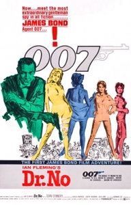
    Dr No Poster. Source: http://jamesbond.wikia.com/wiki/File:DrNoposter.jpg

    Dr No Poster. Source: jamesbond.wikia.com/ wiki/File:DrNoposter.jpg

    A feature of the films is the protagonist’s “hyper-mobility”, as Dodds labels it, with the “footloose spy” hopping from place-to-place, sometimes traversing the globe in the two-hour adventure. This demonstrates the exciting lifestyle of the fictionalised espionage world, brings the film to new and exotic locations, shows the high-level stakes involved and helps keep the plot moving along nicely.  In The Living Daylights (Dalton, 1987), for example, his movements take him to Czechoslovakia, Austria, Britain, Tangier and Afghanistan. Furthermore, his mobility also sees him going underwater, to the extremes of the planet and even into space. In this regard, Bond’s characteristics – privilege, charisma, occupation, funding, determination, and disregard for rules and authority – combine to make him the ultra-mobile modern man.

    The far-off and exotic settings mainly show a simplified and stereotype-filled view of the world. This is obviously not unusual in cinematic terms, however it was a central element of the Bond Franchise. In the blog, Geographic Travels, it is pointed out that the top most visited cities, besides London (which features in every film except You Only Live Twice (Connery 1967) and Moonraker (Moore 1971)) are Istanbul, Hong Kong and Venice, which evoke ideas of Near East Oriental exoticism, Far East Oriental exoticism and Picturesque Europe, respectively. Furthermore, Bond took us to these marvellous places, which in turn imbued him with their enticing nature. From his first outing to Jamaica to his most recent in Hong Kong, the man and the place define each other.

    However, there is, as always, slightly more to the story. You Only Live Twice (Connery 1967) was based in Japan, and while it may not have offered a holistic or realistic view of the society and culture, it was one of the first times that Japan had featured so heavily in a major Western film since WWII. Just over two decades after that conflict, there would still have been sensitivities and political concerns surrounding Japan, especially in the US. In this regard the exotic location, although simplified, may have provided a service. On a side note, I also came across the idea that the Japanese Secret Service ninjas which stormed Blofeld’s secret volcano lair (the prototypical Bond set-up, satirised in the Austin Powers films) was one of the earliest sightings of ninjas in Western pop-culture.

    Another factor in Bond’s mobility is the role of vehicles. The cars obviously stand out as the main type of transport associated with 007. However, his missions have included boats, naval vessels, planes, helicopters, submarines, trains, cable cars, ski mobiles, a double-decker bus, a blimp, a moon buggy, an autogyro (Little Nellie) a space shuttle, and an ‘alligator’ boat. While many of the vehicular scenes are about chase and explosions, there is also an implicit prioritisation of  the mobile (see my post on Mobilities). Movements, spaces of mobility and mobile locations, which are frequently overlooked in cinema and television matter in the Bond-verse. So, for example, M’s office, complete with Moneypenny, can be on a submarine; the fate of the world can be controlled from an oil-tanker; and, a missing helicopter is central to the plot.

    The collective content of the twenty-three films have so much material jammed into them that it is the stuff of dreams for academics and socio-cultural commentators. There are numerous other topics that could be covered in any geographical discussion of Bond, including gender roles, geo-politics (and the concept of the licence to kill), the theme songs, technology and fashion. But as we know James Bond will return soon, maybe another post might also appear…
  • Exploring Place

    One of the elements of geography that I really like is its implicit focus on exploration. It is based on a fundamental desire to understand the world around us, how it functions and how we interact with it. While in academic terms, this process can be most professional and complex, the core ideas are accessible to all. Particularly, in the ways we can all explore places.

    All places, even everyday normal places, are filled with interesting elements, awaiting discovery. It is relatively easy for anyone to start thinking ‘geographically’ and begin exploring places.

    For example, urban areas have architectural features, especially above street level, which we rarely see, or how many streets do we walk down without knowing there names, or what/who is that monument dedicated to?; while rural areas have a multitude of rich hidden aspects, including rarely travelled roads, wildlife and rare flora, and antiquities.

    I would encourage everyone to engage with their local places and landscapes, to seek out the multitude of features, to appreciate their worth and to tell others. This exploration can be a purposeful encounter, or it can be something you incorporate into your routine. The important thing is that we carefully consider the world around us, in all its richness.

    Simple Explorations:

    • Observing an urban space: Find a spot you can comfortably sit or stand and observe for about 15 mins. Remain relatively stationary and look at everything that is around you (the physical and human-made landscape) and all that is happening around you (activity, weather, movement). After a few minutes, you will notice things you’ve never seen before; they’ve always been there, you just didn’t notice.
    • Re-routing: Try and take a different route than you normally would for a journey. We all get so used to travelling certain ways and can forget about streets and passages which may be different or even slightly longer, but may be more pleasant or may even prove to be more efficient at some times!
    • Who’s about (and who’s not): When you’re moving around – out shopping, at work, in school, socialising – look at who is around you? Is it all people your age? People from the same area as you? People who look, move and act like you? Are there more or different people? If not, why not?
    • Visit your place: Be a tourist for a day. So many of us have never been to the main tourist attractions in our own cities! Take an afternoon to visit that place, check it out.

    Suggested readings:

    Place Hacking 

    Placehaking or Urban exploration is a research type, a hobby and an interesting feature of contemporary urban living. It involves ‘recreationally trespassing’ into derelict sites, or, as they can be called, T.O.A.D.S.: temporary, obsolete, abandoned or derelict spaces.

    Bradley Garrett, who completed his PhD thesis on urban exploration in the Department of Geography, at Royal Holloway, University of London, is among the foremost proponents of Plachacking. His excellent blog Placehacking illustrates the richness and insight which this activity offers. Furthermore, the blog shows how the integration of different media can offer a fuller experience of place on line.

    Check out highlights from the blog:

    London Underground 

    Places & Spaces

    Adventurers’ Club 

    Other articles on Placehacking from

    The Guardian, the Shortcuts Blog from The Guardian and GeoDirections Blog:

    For more or similar, see:

    Promise of Place: A document that offers tips and techniques for exploring place, from Promise of Place, a place-based education organisation.

    Mental Mapping 

    National Geographic’s Guide to Mental Mapping: How to use mental maps to organise information about people, places, and environments in a spatial context.

  • Radio, Podcasts and Place

    I listen to radio frequently, with one always on at home and when I drive. I also listen to many podcasts, mainly as I walk. I subscribe to different shows, some of which are radio station content that is recorded and made available for download and others which are exclusively produced as podcasts.

    Form a geographic perspective, I am struck at how radio shows and podcasts can convey a very rich sense of place. I feel that podcasts/radio are powerful and under-appreciated tools for describing the world. The limitations of the medium require presenters, reporters and producers to compensate by combining thick description with high-quality sound recordings. Podcasts, and audio more generally, can play a significant role in exploring, understanding and presenting places. I’ve chosen three examples to illustrate this point.

    The first, is an episode of the NPR programme Hearing Voices, which is a weekly show that presents a series of segments, mostly collected from radio broadcasts, documentaries, podcasts and found-sound, relating to a single theme. The episode, Sacred Places (HV079), presents a selection of short pieces that really capture the essence of the places, and the people and practices involved. You can experience the Hindu holy city, Vrindavan through ‘talking notes’ and a the background track of the ambient sound, and get a sense of a Lutheran Church in Montana through an interview intermixed with sounds from services at the Church. It is a really fascinating episode, which I find myself returning to time and time again.

    The Royal Canal is a beautiful piece that uses the qualites of good radio/podcasting to portray a journey down a waterway. It is an episode of the Curious Ear, a short radio documentary series that is produced by RTÉ Radio 1, the Irish national public broadcaster. It features “Six miles of canal; six miles of stories”, as it follows the presenter/producer Ronan Kelly as he canoes along the Royal Canal in Dublin city. The use of recordings of the water and paddling is particularly evocative.

    This final example is more meta, in that it is a podcast that is about making or understanding/analysing radio and podcasts. How Sound is a very interesting short show, from PRX, the Public Radio Exchange, that explores the world of audio and radio/podcast making. The episode, Show, Don’t Tell, looks at how sound and recordings can be effectively used to demonstrate a topic to listeners, such as recordings of the presenter walking waste deep into ocean water and the difficulties of a man in a wheelchair trying to exit his car in an unsuitable disabled parking space.

    Radio, podcasts and the use of audio more generally raises questions about how researchers present their work, especially geographers. Ultimately, most academic work is conveyed in text, which is supported, sometimes, by illustrations, diagrams and maps.  However, audio is rarely used. The potential that it offers is considerable, especially in examinations of place. In my research, I frequently make audio recordings, even if it is just of the ambient sound. The use of such recordings are an important component of my methodology, which tries to gain a deep appreciation of the places being studied. I would encourage other researchers to consider the role that audio can play in their research.

    Audio version of this blogpost

  • Sharing Cork

    Sharing Cork was a project I ran as an experiment for Geography Awareness Week 2012. I was interested in  developing an online project and engaging with social media.

    This year was the first time there was a Geography Awareness Week national programme being run in Ireland, with the Geographical Society of Ireland (GSI) in conjunction with the Association of Geography Teachers in Ireland (AGTI) coordinating the events. Sharing Cork was run as part of this, which assisted in its promotion.

    Sharing Cork was an online project which centred on my home city of Cork. It aimed to use social media to crowd-source contributions. I asked people to record (photo, video, audio recording, drawing etc) a part of their daily life and share it. Emphasis was put on the everyday angle behind the project.

    Participation in the project was explained as being as simple as ‘Record, Share, Enjoy’. Someone was to take a photo (or make a video, record audio, drawing or painting) of a place, activity or encounter from our daily life. Then, they shared it using  email, Twitter, Facebook, or by sharing a link from a site/page where they hosted their materials (eg. youtube, flicker, wordpress, audioboo).  Contributions were gathered, collated and shared in one place (via this site) for everyone to enjoy and hopefully learn from it.

    As well as being an interesting project for Geography Week, I intended to use it as a means of engaging with social media as a tool and to practice developing a site and online project. I consider it a success in terms of the latter motivation. I was able to use WordPress to generate a site and then link it in with social media. That link proved essential as both the Twitter and Facebook incarnations of the project generated specific interactions and contributions. The experiment with social media was limited in its impact, but nonetheless it showed the potential for the use of these platforms in research.

    Overall, I was reasonably pleased with the endeavour. The technical aspects worked, I got some contributions and I am more convinced than ever  about the growing role that social media and the web will play in research.

    The stats

    Website: It received 187 views (a unknown, but sizeable portion were from me). Monday 12th Nov was the day it received the most views, with 72 hits.

    Facebook page: 37 Likes (15 of whom are friends of mine on Facebook); the ‘Reach’, the number of individual people who have seen a post, of individual posts ranged from 0 to 43; there were 33 posts on the page, 26 of which were by me.

    Twitter: The twitter account had 43 followers, with it following 125 accounts – most followers seem to respond to being followed (especially since most were Cork-based organisations or businesses who have an interest in generating and connecting with followers). The account received 15 mentions and 19 retweets, 10 of which were by me via other accounts.

    Improvements for next year

    If I am going to do this, or something like it, next year (or in the use of websites and social media for my research), there are several lessons learnt:

    • Start early and promote in the lead up: I developed the project late, within a few days of the actual Week, and had little time to get the word out.
    • Engage with people and organisations that have strong social media presence: A retweet or a posting form the right person or organisation can have a significant impact. Also, contributions can be solicited from people or representatives directly.
    • Be persistent  In the ‘shallow’ online world, which has little memory, you need to ensure you have a continuing presence and relevance.

    Some Contributions


    Outside the Geography Building, UCC: 8am 2/11/12

    The WWI Memorial monument, South Mall, on 11th November, shortly before the commemoration event.

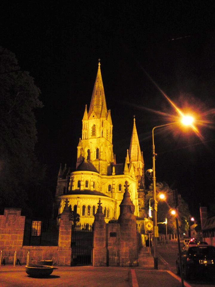
    St Finbarre’s Cathedral at night. While it looks beautifully lit here, one person I know who lives close finds the constant yellow glow in the sky a disturbance… (Courtesy of S. O’Connor).

    Foggy Cork, Glucksman Gallery, UCC (7.56am 15/11/12). It’s one of those foggy mornings that completely transforms the landscape, even in the city. While UCC is, in places, a green oasis within the city, this part of its character is emphasised in the fog, when visibility is limited. In the closeness of the fog everything seems quiet and isolated.

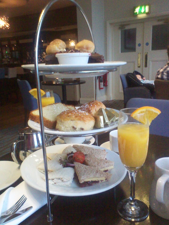
    Afternoon tea in the The Montenotte Hotel #gaw #sharingCork (Courtesy of M. Murphy).